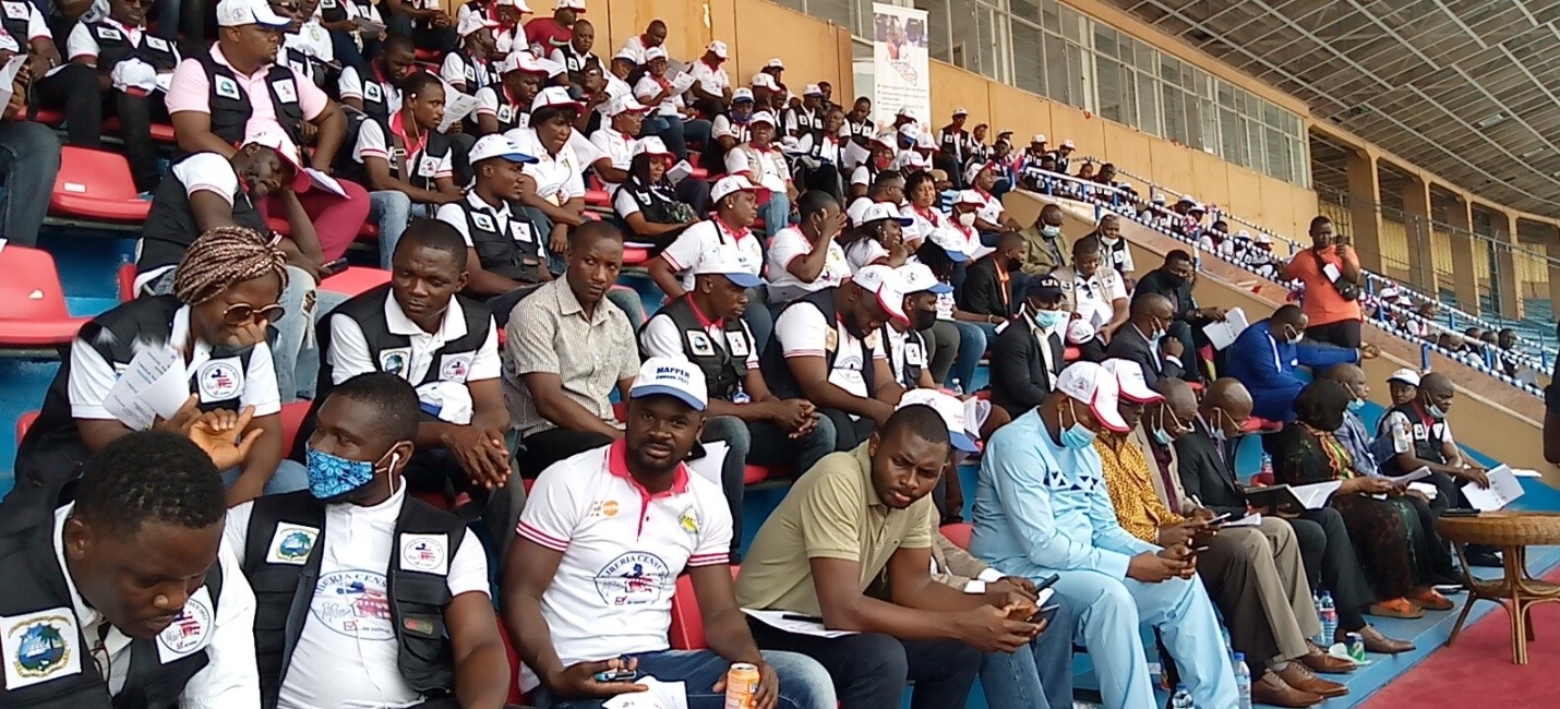
PHOTO: Partial view of the Mappers
By Fetus G. Frazer, Jr., efgfrazerjr@gmail.com
Monrovia – The Liberia Institute of Statistics and geo-information Services (LISGIS) and the United Nations fund for Population Activities (UNFPA) has deployed Geographic Mappers for the 2021 national population and housing census.
The official deployment ceremony was held at the Samuel Kanyon Doe Sports Complex in the Paynesville suburb of Monrovia, on Thursday, April 1, 2021.
A geographic information system (GIS) is a system designed to capture, store, manipulate, analyze, manage and present all types of geographical information and data. Cartography serves three purposes: planning and supervising operations, census data collection, and analysis and presentation of results.
Census enumeration area (EA) maps are used to identify enumeration areas (EAs) in the field by census enumerators for data collection, and to avoid omission or duplication of coverage of the entire country. Therefore, the role of the Mappers, generally, is to delineate enumeration areas through the creation of area maps.
Speaking during the program, the resident Representative of UNFPA, Dr. Bannet Ndyanabangi said, the census project is conceived and designed by the Government of Liberia and its partners, including UNFPA, to provide complete coverage of support, utilizing agencies’ comparative advantage to achieve the overall goal of strengthening data systems in Liberia.

The Geographic Mapping exercise will provide the necessary tools (data) for overall national development planning, programme implementation, monitoring, and evaluation.
The UNFPA Representative said on October 8, 2019, the Liberian government and Partners signed the Census Project Document, signaling the start of implementation activities, and on 25th September 2020, President Dr. George Manneh Weah, Launched the start of Public Engagement for fieldwork.
As an update, Dr. Ndyanabangi disclosed that, a lot has been achieved including the acquisition of state-of-the-art technology, Satellite Imagery for Liberia, Google Cloud Storage Services, Survey 123 application; Tablets, Vehicles, and human expertise are all in place.
Mr. Ndyanabangi said about 200 Field Mappers, Supervisors, and Coordinators have been trained in the use of modern digital mapping applications and will be deployed nationwide on Friday, April 2, 2021.
“The main purpose of this program is to seek the Government of Liberia and the entire citizenry’s buy-in in helping to create awareness, participation, cooperation, and support for the mapping exercise nationwide. The GIS Mapping exercise is the most critical and crucial in the conduct of a successful census because it sets the stage for all other stages. It has to be done correctly or all other aspects of the process will be wrong.],” The UNFPA Country Representative, stressed.
Also speaking during the program, the director general of LISGIS Prof. Francis Fonanyenneh Wreh said, the 2021 census is the first digital census to be conducted in Liberia. The 2021 census is the fifth national population and housing census. The first four having been held in 1962, 1974, 1984 and 2008 respectively.
According to the LIGIS Director, during the mapping exercise, all buildings in Liberia including schools, churches, mosques and hospitals will be geo coded. He used the occasion to call on Liberians and the media to support the process.
“We want to inform you that this will be the first census in the history of Liberia to use technology, the 231 application.” He disclosed.
At the same time, Liberia’s Minister of Finance and Development Planning, Samuel D. Tweh said the momentum of the 2021 census needs to be sustained adding that the committed itself to the process by proving a million dollars in the current budget year which is expected to be disbursed in the next couples of weeks.
Minister Tweh, who is also the chairman of the board of LISGIS called on the Mappers to put in their best to ensure that the 2021 becomes the most accurate census in the history of Liberia.
“We depend on you to put in your best, if development must come. We will be watching you as you go into the fields,” the Finance Minister maintained.
Liberia’s Vice President, Jewel Howard-Taylor, who served as proxy for President Weah during the deployment ceremony, called on citizens hailing from other counties but living in Montserrado County to go back to their various counties to be counted. “I encourage all of us to go home to be counted and be identified to vote,” she cautioned.
To make the census effective, the Mappers will use the GIS to make their work easier.
A population and housing census is an enumeration of the total population of a country, which provides data on the number of people, their spatial distribution, age and sex structure, their living conditions and other key socioeconomic characteristics. It is used to determine the demographic, social, economic and cultural characteristics of the population of a county. It also provides small area data; create sustainability of data collection analysis.

