
By Moses M. Tokpah, mosesmtokpah@gmail.com
KAKATA, Liberia- The Executive Director of the Liberia Institute of Statistics and Geo-Information Services (LISGIS), Professor Francis Fonanyeneh Wreh has vowed ‘to spend sleepless nights’ in ensuring the successful implementation of the pending national population and housing census.
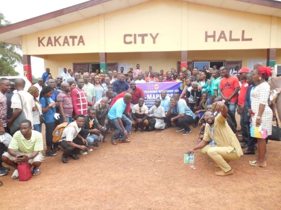
He made the promise at the opening ceremony of the Mapping Assistants workshop of the National Housing and Population Census of Liberia held at the Kakata City Hall on Monday February 24, 2020.
More than one hundred (100) persons drawn from Liberia’s fifteen Counties are participating in the twenty-four (24) days intensive training in Kakata Margibi County. And the United Nations Population Fund (UNFPA) is one of the main supporters of the project.
Prof. Wreh noted that the census has experienced some significant delays due to untimely and inadequate funding.
He said that this is one major reason why Liberia has gone beyond the nationally stipulated ten years as the period of census taking (as enshrined in Article 39 of the 1986 Constitution of Liberia) was exceeded.
However, Prof. Wreh said LISGIS is still operating within the 2020 round of population and housing censuses (2015-2024) as cherished in the United Nations principles and recommendations for census taking.
He indicated that the forthcoming national housing and population census of Liberia will be the fifth and will be the first census in Liberia to use digital technology at all phases of preparation, geographic planning, census-taking, data management, processing, tabulation, publication, archiving and dissemination.
He disclosed that the Liberia Institute of Statistics and Geo-Information Services in collaboration and support from UNFPA developed a comprehensive census project document that will serve as source for support.
It will also be used for resource mobilization for all processes of the 2021 census undertaking.
The LISGIS boss also expressed hope that the document will assist in resource mobilization especially from development partners to participate in this massive project during the current global economic challenges.
He indicated that the geographic planning exercise will lay the basis for a successful conduct of the enumeration of the population and it is the first major activity in the implementation of any census under best practice.
Meanwhile, Prof. Wreh has described the Kakata training workshop for the Mapping Assistants marks as the beginning of the National Housing and Population Census of Liberia process.
LISGIS conducted a nationwide recruitment of GIS/Mapping assistants to complement the capacity of its GIS and cartographic potential, he disclose.
The LIGIS boss also said that those recruited as well as those with past experience in the execution of similar tasks needed to undergo specialized training tailored to emerging GIS technology that will be used for the GPS.
“You will be required to use the digital mobile mapping devices to geocode every existing building structure/landmark and infrastructure on the landscape; you will be required to demarcate and map enumeration areas that will be used for the census, you will be provide household listing and estimated number of persons per household in every demarcated enumeration area as a geographic database indicated against which the population database would be compared,” Prof. Wrah explained.
He maintained that in order to reinforce the technical capacity of the census cartographic team, two international residents experts in the field of Geo-Information Service (GIS) have already been hired by LISGIS and UNDP are in the training workshop.
LIGIS says training methods will include lectures, practical hands-on demonstration, group work and assignments and tutorials with periodic assessments. “Giving the large number of participants and variation of knowledge levels in GIS and use of digital devices, the formation of small groups for knowledge sharing and tutorials will be also employed for better management and conducive learning,” he said.
He stated that at the end of the workshop participants are expected to capture GPS coordinates for all building structure/landmarks and other infrastructure using the available technological devices, demarcate the enumeration area maps.
The maps will be used to guide enumerators to easily identify their assignment areas/locations/structures for the main census phase as well as generate and prepare household listings for all Eas across Liberia.